
Cities
A demolished wall usually survives as a ring road and a set of gate names
Town walls shaped the plan inside them so thoroughly that removing the stone changes surprisingly little, and the line they occupied is generally still doing work.
By Pranav Kulkarni4 min read
A wall is a legal boundary before it’s a military one
It is tempting to read a town wall purely as defence, and defence certainly paid for it. But a wall also defines where a set of rules applies. Inside it, market privileges, tolls, guild membership, taxation and the right to trade all operated differently from the fields and suburbs immediately outside.
That is why the gates matter more than the curtain. A gate is where goods were counted and charged, which made it an administrative instrument as much as a door, and it explains why gates were often rebuilt in grand style long after they had stopped being defensible in any serious sense.
It also explains the odd settlements that grew just outside. Suburbs beyond the gate housed the trades that were noxious, bulky or unwelcome within the walls — tanning, slaughter, brickmaking, sometimes inns for travellers arriving after the gates closed — and many of those districts still carry a slightly different character.
Enclosure compresses everything inside it
Land inside a wall is finite and can’t be extended, so it becomes expensive in a way that land elsewhere doesn’t. The response is always the same: plots get narrow, buildings get tall, upper storeys project over the street, courtyards get built into, and gardens disappear one at a time over a couple of centuries.
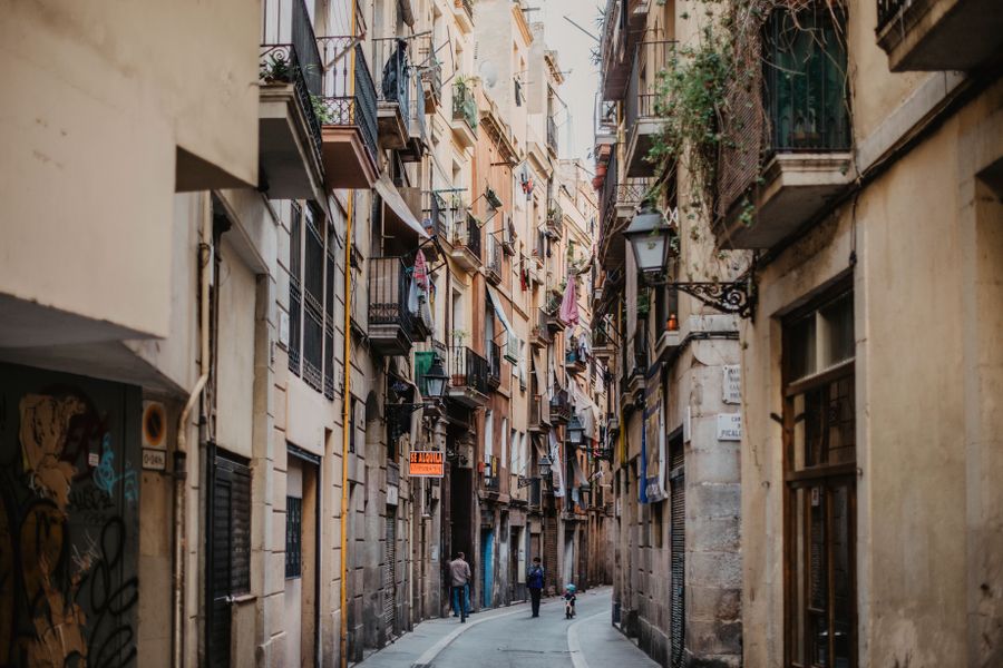
Streets inside walled towns therefore tend to be narrow not because medieval builders were careless but because frontage on a street was the scarce commodity being rationed. A long thin plot running back from a short street frontage is the standard unit, and you can see it in the roofline of any surviving old town.
Circulation follows the gates. Since everyone entering or leaving passed through a small number of openings, the main streets are the ones connecting gate to gate or gate to market, and those routes are still the busy ones now, several hundred years after the reason for them was demolished.
Walls came down for money and traffic more often than for peace
Artillery made high masonry walls militarily obsolete well before most of them were removed, and what actually triggered demolition was usually pressure of a different kind. The wall was a barrier to traffic, a barrier to sanitation, and — decisively — a very large strip of publicly owned land in the most valuable part of a growing city.
That last point is the one that explains the timing. A municipality that removes a wall acquires a continuous ribbon of buildable and sellable ground, and the proceeds frequently financed the boulevard, the parks and the public buildings that replaced it. Vienna’s Ringstrasse is the most famous instance of exactly that transaction.
The decision was contested at the time in many places, and by the later nineteenth century a preservation argument had appeared alongside the commercial one. Some cities compromised by keeping a gate or a tower as an ornament in the middle of a new junction, which is why so many stand oddly isolated today.
What is left is a shape rather than a structure
The clearest survival is the ring. A boulevard, an inner ring road, a tram loop or a curved sequence of streets bending where no natural feature explains the bend is very often a wall line, and following it on foot is a quick way to establish the outline of the old town.
The ditch has its own afterlife. Because it was a continuous depression in public ownership, it became parkland, a canal, a railway cutting or, in the twentieth century, a road — which is why a green belt of gardens hugging one side of an old centre is such a common European pattern.
Names outlast everything else. A square called after a gate that no longer exists, a street whose name means the outer side, or a bus stop named for a bastion will keep the memory going long after the last stone is gone. Bollards or a change of paving sometimes mark the exact footprint.
Keeping a wall is not free, and the towns that did know it
The places that still have complete circuits are usually places that stopped growing at the right moment, because a town that boomed in the nineteenth century almost always removed its constraint. Preservation is often a byproduct of economic stagnation, which is a slightly deflating thought but broadly true.
Maintaining masonry of that scale is a permanent expense, and the money now generally comes from visitors, which creates its own tension. Walkable wall walks, ticketed sections, lighting schemes and reconstructions of missing towers are all reasonable, and all of them move the object further from what it was.
For a visitor, the most rewarding walled towns tend to be the ones where the wall is still doing something ordinary rather than being presented. A circuit used as a shortcut by people going to work, with washing lines and back gardens against the inner face, tells you more than a restored gatehouse with an interpretation board.
Common questions
How do I find the wall line in a city that has demolished it?
Look at a map for a closed curve that no river or ridge explains, then check the street names along it for gates, ditches and bastions. Older cities usually mark the line with a change in street width, and museums often sell a plan showing the circuit at its greatest extent.
Were all town walls built at once?
Rarely. Most grew in stages, with an inner circuit enclosing the original core and later circuits taking in suburbs that had already been built, which is why some cities show two or three concentric rings in their street plan and why an inner gate can sit well inside the later boundary.
Is a reconstructed section worth visiting?
It depends what you want from it. A reconstruction is good for understanding scale, sightlines and how a gate worked, and poor as evidence of what actually stood there. Most sites are honest about which parts are original, and it is worth reading that label before drawing conclusions.
Consumer editor, The Next Postcard
Pranav joined to cover cities, slow routes, rail & road and stayed for the awkward questions and is happiest when a piece answers the question completely.


