
Coast
Tides are a timetable and most coasts run on it
The rise and fall of the sea is predictable years ahead, varies enormously from one coast to another, and quietly governs when a harbour, a causeway or a beach is usable.
By Clara Lindqvist4 min read
The moon sets the rhythm and the sun modifies it
Tides are caused by the gravitational pull of the moon and, to a smaller extent, the sun, acting on a body of water that is free to move. Because the moon takes a little over a day to return to the same position relative to a point on the earth, the tidal cycle drifts later each day rather than repeating at the same clock time.
That drift is the first practical fact. If high water is late morning today, it will be roughly an hour later tomorrow, so a beach that was perfect at eleven will be a different proposition at the same hour two days later. Anyone planning several days on a coast needs the pattern rather than a single reading.
When the sun and moon line up, their pulls combine and the range between high and low water is at its largest. When they are at right angles, the range is at its smallest. These are the spring and neap tides, and spring in this context has nothing whatever to do with the season.
Range varies wildly between coasts and the reason is shape
The difference in height between high and low water is modest on some coasts and enormous on others, and the variation is not about latitude. It is about the shape of the sea basin and the coastline, because a tidal wave entering a funnel-shaped bay or a shallow shelf gets amplified as it is squeezed.
This is why some enclosed seas have a tidal range small enough that it barely registers in daily life, while certain bays and estuaries elsewhere have ranges measured in many metres. Two coasts a few hundred kilometres apart can behave completely differently.
The consequence for a traveller is that habits learned on one coast do not transfer. Somewhere with almost no tide, a harbour works all day and a beach is the same shape at any hour. Somewhere with a large range, half the day is a different landscape from the other half.
A big range changes what a coast is for
On a high-range coast, harbours dry out. Boats sit on the mud at low water, ferries and fishing vessels can only enter and leave within a window either side of high water, and the working day of a whole port is organised around that window rather than around office hours.
Causeways to tidal islands are the sharpest version of this. A road exists for a few hours, then does not, and the tide comes in across flat ground faster than people expect. Local authorities publish crossing times for exactly this reason, and the vehicles pulled off those roads every year are a reliable sign that the published times are not conservative fiction.
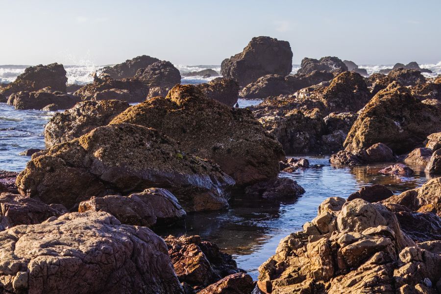
The intertidal zone itself is one of the reasons to be on such a coast at all. A wide sand or rock flat exposed twice a day supports a specific kind of life and a specific kind of gathering, from shellfish beds to bait digging, and it is only accessible on the falling tide.
Tides interact with waves, wind and current
Tidal water moves horizontally as well as vertically, and in narrow channels between islands or through the mouth of a bay, that flow can run at a speed that dominates everything else. Small boat schedules in such places are set by the direction of the stream rather than by demand.
Where a tidal stream runs against the wind, the sea gets steep and short very quickly, which is why the same stretch of water can be flat in the morning and unpleasant in the afternoon with no change in wind strength. Ferry crews know these windows precisely.
Swimming conditions change with the state of the tide too, and not always in the same direction. On some beaches the flooding tide brings warmer water over sun-heated sand; on others it exposes rip currents or a step in the beach profile that was not there an hour before.
Tide tables are ordinary, published and worth reading
National hydrographic offices and port authorities publish predictions well in advance, and they are as close to reliable as anything in this field, because the astronomy behind them is precisely known. Weather can push actual water levels above or below prediction, particularly with strong onshore wind or low pressure, but the timing holds.
A tide table for a named port applies to that port, and the timing shifts along a coast, sometimes by a considerable margin over a short distance. Local tables or a stated correction for a nearby point are what you want rather than a national figure.
The habit worth acquiring is simply to look at the day tide before planning a coastal walk, a boat trip or a long afternoon on a beach below a cliff. Being cut off by a rising tide under a cliff is one of the most common and most avoidable coastal emergencies, and it happens to people who simply did not think of the sea as something with a schedule.
Common questions
Why does my beach have two high tides a day and another has one?
Most coasts have two roughly equal cycles a day, but the shape of some sea basins produces one dominant cycle or two very unequal ones. It is a property of the basin rather than of the beach, and local tide tables show the pattern immediately.
Are tide tables accurate enough to trust for a causeway crossing?
The astronomical prediction is reliable, and the safe crossing window published by the relevant authority already includes a margin, which is why it is shorter than the period the road looks dry. Wind and atmospheric pressure can raise or lower actual levels, so the published window is the figure to use.
Does the tide affect fishing and seafood availability?
Considerably, since boats in drying harbours can only work around the tide and shellfish gathering happens on the exposed flats at low water. In small ports this is visible in when the catch lands and therefore in when the restaurants around the quay have anything fresh to sell.
Staff writer, The Next Postcard
Clara joined to cover cities, slow routes, rail & road and stayed for the awkward questions and reads the small print so you do not have to.


