
Coast
Hard rock and soft rock make completely different coastlines
The geology behind a shore decides whether you get cliffs, bays, dunes or marsh, and reading it explains why neighbouring stretches of the same coast feel unrelated.
By Arjun Nair4 min read
The sea attacks everything, just at different speeds
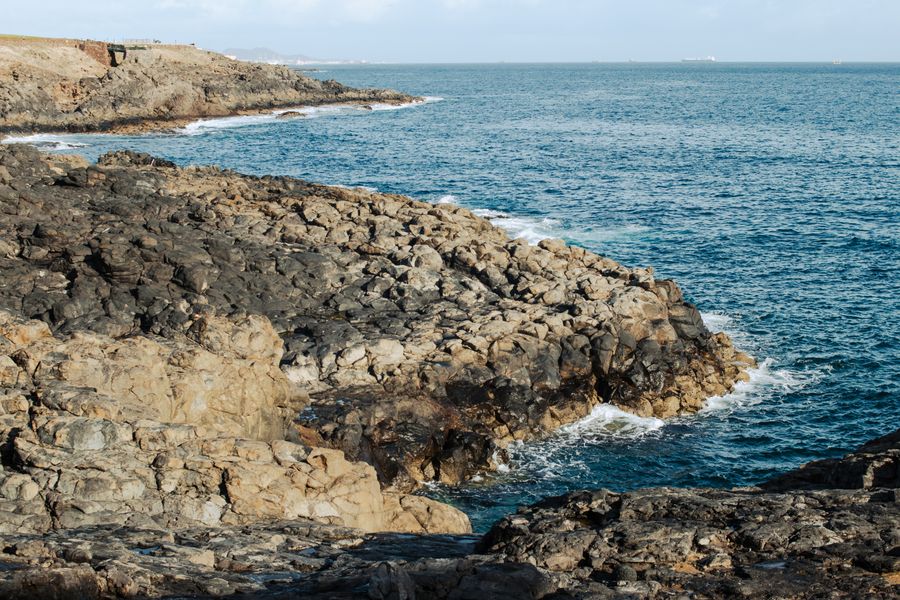
Waves apply the same force along a stretch of coast, but rock does not resist uniformly. Hard, well-cemented rock retreats slowly and stands as headlands and cliffs. Softer material — clay, poorly consolidated sands, weak shales — is removed comparatively quickly and becomes bays, slumped slopes and low ground.
That difference produces the alternation of headland and bay that appears on coastlines everywhere. It is not decorative variety; it is a map of the underlying material, and the geological boundary usually runs out to sea at the point where the coast changes character.
The direction the rock layers run matters as well. Where hard and soft bands meet the sea at right angles, you get the classic sequence of bays cut back between resistant headlands. Where the bands run parallel to the shore, the coast can stay straight for a long distance until the sea breaches the outer band and opens a broad harbour behind it.
Cliffs fail in ways that depend on what they are made of
A cliff is not simply worn away from the front. It is undercut at the base by waves, then fails from above under gravity, and the shape of that failure is set by the rock. Strong jointed rock breaks off in blocks and leaves a vertical face. Clay slumps in curved slips that leave a stepped, hummocky slope covered in vegetation.
Water in the rock is often the trigger rather than the sea itself, which is why many cliff falls happen after heavy rain or a freeze rather than during a storm. That is also why the fresh, pale scars on a cliff face are worth noticing: they are recent and they mark active sections.
The practical consequence is simple and worth stating plainly, because people are hurt every year. The base of an actively eroding cliff and the edge above it are both hazardous, warning signs on coastal paths are there for specific local reasons, and an overhang of turf at a cliff top may have nothing underneath it.
Caves, arches and stacks are one process caught at different moments
Where waves exploit a weakness in a headland, they open a cave. If the cave cuts through, it becomes an arch. When the arch collapses, the outer part remains as a stack, and the stack eventually reduces to a stump visible only at low water.
Seeing all four along one coast is common, and it means the same process is running at different stages on the same rock. That is one of the reasons a geological coastline rewards walking rather than driving between viewpoints; the sequence only makes sense strung together.
These features are also inherently temporary. Well-known arches collapse, and the collapse is normal rather than remarkable, though it is often reported as if a landmark had been vandalised by the sea. The sea was always going to do that.
Soft coasts are where the interesting habitats are
Where the shore is made of loose material rather than rock, the coast is mobile and produces spits, bars, dunes, saltmarsh and lagoons. These landforms are built rather than carved, and they exist in a balance that can shift within a single storm.
They are also the most biologically productive parts of a coastline by a wide margin. Marsh and mudflat support enormous numbers of birds, dune systems hold specialised plants, and lagoons behind bars are nurseries for fish. That value is why so many of these places carry conservation designations that restrict access at certain seasons.
For a visitor, the etiquette follows directly from the fragility. Dune systems are held together by vegetation and by fences that look pointless, and a path worn through a dune ridge can become a blowout that destroys a section of it. Marked routes on soft coasts exist for the landform as much as for the walker.
Reading a coast before you get there
Geological maps for most countries are freely available and are far more informative about what a coast will look like than a photograph is. A boundary between two formations crossing the shore predicts a change in cliff height, beach material and often in the colour of the sand.
Place names help too, since coastal naming is unusually descriptive across many languages: words for head, point, nose, gap, sand, mud, black rock and white cliff recur, and they were given by people who worked the water and needed the names to be accurate.
The honest caveat is that all of this describes tendency rather than certainty, and coastlines are complicated by past sea levels, by glaciation, by rivers and increasingly by engineering. A sea wall or a groyne field can override the natural pattern completely along one town frontage while the coast either side behaves normally.
Common questions
Why is the cliff crumbling in one bay and solid in the next?
Almost always because the rock changes. A boundary between a resistant formation and a weaker one commonly runs across the coast at a headland, so two adjacent bays can have entirely different erosion rates and entirely different beaches.
Are cliff falls more likely at particular times of year?
They are frequently associated with wet periods and with freeze and thaw, because water in joints and pore spaces is what triggers many failures. That said, an undercut section can fail at any time without warning, which is why the base of an active cliff is not a place to sit.
Is it worth carrying a geological map on a coastal walk?
For anyone interested in why the landscape looks as it does, yes, and many national surveys publish simplified versions or free online viewers. It turns an attractive walk into a legible one, since the changes underfoot start corresponding to something you can see on paper.
Features writer, The Next Postcard
Arjun has written about cities, slow routes, rail & road for most of the last decade and prefers a plain explanation to a clever one.


